Rapid Alert and Information Network
It is no secret that Broward County is highly vulnerable to roadway flooding, and those floods are becoming more frequent and severe. The April 2023 storm made that reality clear, leaving more than 5,000 vehicles damaged and prompting dozens of water rescues.
During that event, there was no real-time way for the County to know which roads were underwater or to share that information with drivers and first responders.
In the past, the County had to rely on field crews or phone calls from residents to find out which areas were flooding. Today, that approach is no longer enough. Florida’s weather is unpredictable and often hyperlocalized, with one street under water while the next stays dry.
With Broward County now Home to more than two million residents and some of the busiest roads in the state, the need for a modern, connected flood awareness network has never been greater.
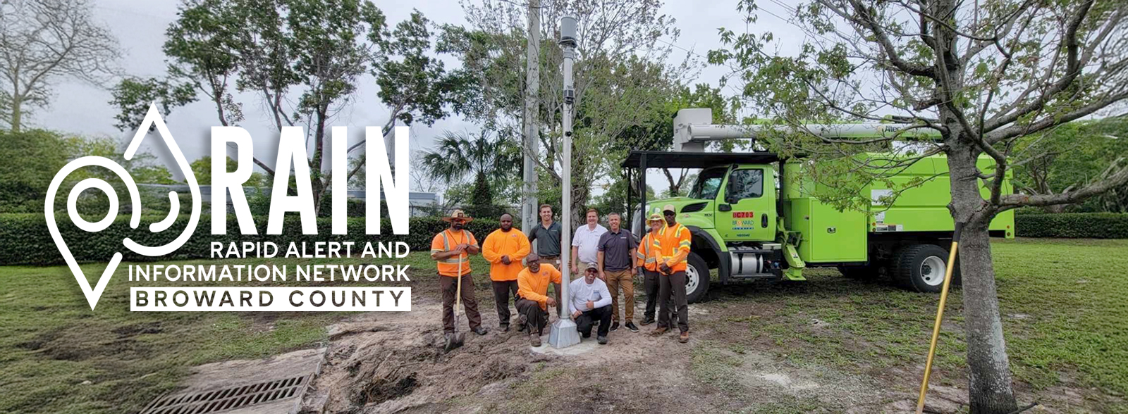
To meet that challenge, the Broward County Resilient Environment Department is launching The Rapid Alert and Information Network, or RAIN, a countywide system designed to monitor real-time environmental conditions, detect roadway flooding as it happens, and alert commuters and public safety crews to hazards as they develop.
Over the past year, the department conducted a pilot study and an extensive information-gathering campaign to identify the most effective technologies and learn from other communities already using similar systems. This effort included field visits to active networks in Texas, partnerships with the University of Georgia, and collaboration with multiple Public Works divisions. The pilot program tested several sensor configurations and communication methods, and now, with dedicated funding secured, the County is ready to expand the system.
At the heart of RAIN are sensor towers, compact and solar-powered telemetry units connected to pressure transducers installed within roadside catch basins. As water levels rise, these sensors measure flood depth and send data to a central dashboard. This allows County staff and the public to see real-time flooding information across key locations without having to send crews into the field.
Broward County Public Works has played an integral role in the execution of RAIN’s pilot phase. Without the help of Traffic Engineering, Highway and Bridge Maintenance, and Highway and Bridge Construction, this project would not have been possible. These partners helped procure materials, navigate the permitting process, and install the pilot locations. We look forward to our continued partnership as our departments merge.
Because Broward is a densely developed area, it is not practical to install a sensor on every block. To address that, the County is exploring the use of artificial intelligence (AI) to model and predict flooding between sensor locations. These models will provide countywide visibility and forecasting capabilities as the network grows, improving both the speed and accuracy of flood detection.
Current work is focused on establishing interlocal agreements with cities throughout Broward County to install sensor towers on municipal roads. These partnerships will help expand RAIN’s coverage and data-sharing capabilities. The long-term goal is a connected, intelligent flood monitoring network that improves public safety, supports emergency response, and strengthens Broward County’s resilience in the face of a changing climate.
The County is also building on existing technology to enhance RAIN. Broward’s LiDAR (Light Detection and Ranging) systems are being used to identify flooding hotspots with millimeter-level precision. The County’s Innovation Unit is integrating these LiDAR scans into 3D modeling technology to create visual projections of flooding at specific sites. These realistic models will help the residents and emergency planners see how flooding events affect specific locations and convey the danger.
A Broward County first, LiDAR data collected by Dr. Greg Mount was successfully converted into a 3D mesh by Michael Trujillo. Allowing Michael to create realistic flooding events and 3D scenes. Future work will aim to integrate 3D scenes with sensor information to illustrate conditions throughout the County.
In addition, the County is exploring ways to share this information directly with drivers. Integration with commuter apps such as Waze could allow flood alerts to appear in navigation systems, helping motorists reroute quickly and safely. This could also ease congestion and reduce the number of stranded vehicles and emergency calls during heavy rain events.
The launch of RAIN marks a major step forward in Broward County’s efforts to create a safer and more resilient community. By combining sensors, modeling, and advanced communication tools, RAIN will give residents, first responders, and public works teams the real-time information they need to make better decisions and stay safe during storms. As Broward County continues to adapt to the challenges of a changing climate, projects like RAIN show how innovation and collaboration can protect people, safeguard infrastructure, and keep our roads open when they are needed most.
