
GIS: The Powerful Intersection of Data and Location
Geographic Information Systems (GIS), simply put, are powerful tools and technology that allow users to visualize, analyze, and interpret data to understand relationships, trends, and patterns in relation to location and geography.
Gabrielle Drice, GIS Information Systems Manager in Broward County's Urban Planning Division, recently sat down to talk about the County's GIS program, and how this technology is transforming the way organizations, governments, and communities manage and analyze spatial data.
According to Ms. Drice, “GIS is the thread and the interconnectivity of life and of everything that you do." Think of your home address, it is the starting point to connect everything – your water, sewer, electricity, and internet to name a few. Your insurance costs are determined by your location. Traffic signals make decisions based on GIS information. “GIS is everywhere you are."
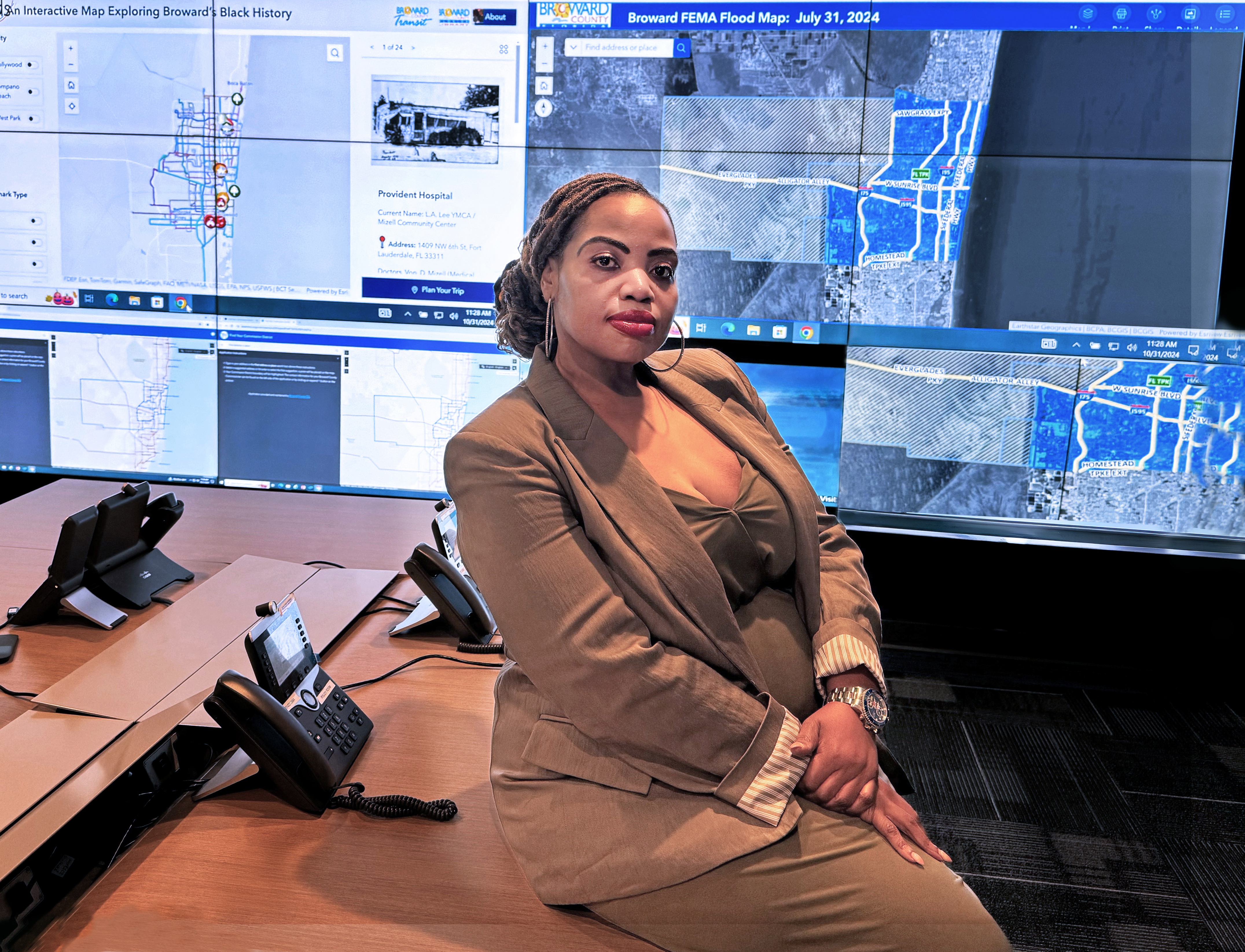
At the Broward County Emergency Operations Center (EOC), Gabrielle Drice
discusses the various maps and dashboards provided by the GIS Program
to aid in decision-making during emergency events.
County-Wide GIS Program
Since 2018 the Broward County GIS program has grown nearly ten-fold, with program users in nearly every County agency. Broward County's GIS program tools have become a resource to improve public services, increase efficiency, and provide real-time decision-making support to agencies and organizations within and outside of the County.
Just a few of the many GIS projects and programs and their far-reaching impact are as follows:
The County Demographics Hub features the 2024
Population Forecast Allocation Model (PFAM). The PFAM analyzes patterns of land development using population forecasts. These forecasts are then modified for future years, based on anticipated changes to development patterns. Municipalities can then use this data to predict where residential growth will occur.
-
What's Cool?: Municipalities can see real-time results, eliminating paper-based processes, and increasing efficiency, and allowing for more accurate and dynamic data entry.
-
Who Benefits: City planners, government officials, and residents benefit from faster and more accurate decision-making regarding city planning and public services.
-
What's New?: Shift from physical, paper-based processes to fully-digital municipal interaction and mapping systems.
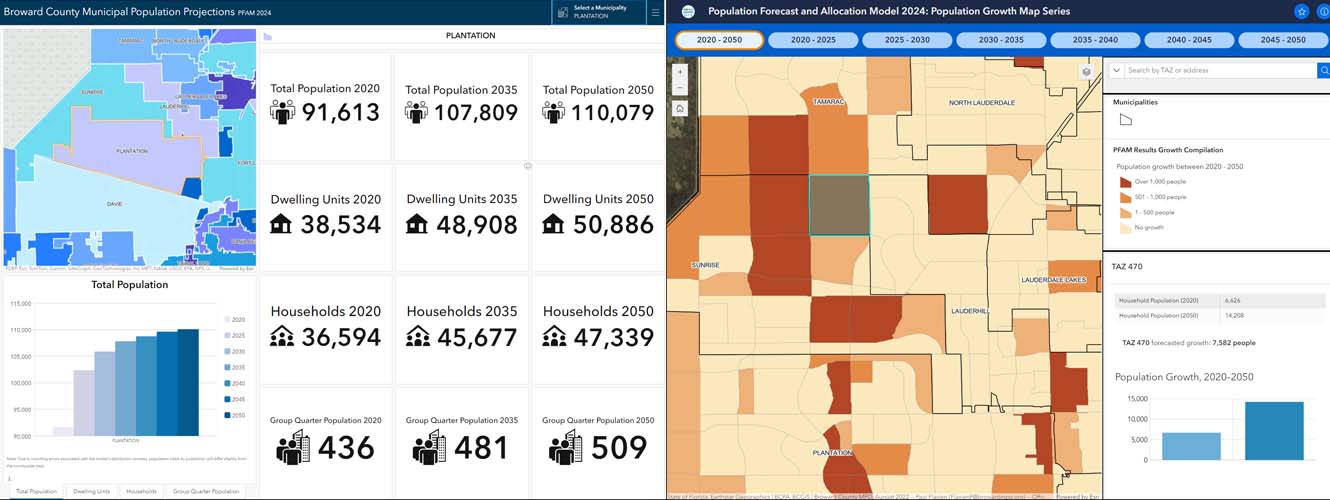
Population Forecasts Maps
Homeless “Point-In-Time" Count Automation
Accurately accounting for the Broward County homeless population and their locations, in order to provide effective services, used to be a slow and tedious process of printing maps, annotating them in the field, and then updating them to a digital format in the office. Now a laptop is taken into the field, and the data being collected is then automatically updated. From there, a dashboard report is created, making the information immediately available to agencies and end users.
-
What's Cool?: Migrating from paper-based surveys to real-time data collection using tablets and live dashboards in near real time.
-
Who Benefits: Homeless services, volunteers, federal agencies -- and ultimately homeless County residents -- by facilitating increased speed in service provided.
-
What's New?: Increased accuracy and efficiency, clearer insights, and faster reporting to federal agencies. This process allows for a more immediate understanding of the homeless population's needs.
Other recent noteworthy GIS innovations include:
-
3D Base Map for Broward Sheriff's Office (BSO)
-
Broward County Transit (BCT) Tracking System
-
“GIS-powered" Mosquito Control with Geo Web Server
GIS Developments on the Horizon
The Broward County GIS program will be moving to a new infrastructure system that will include the ability to leverage artificial intelligence. Dedicated cloud storage capabilities will allow for the storage of the big data needed for real-time program applications. Also, further development of Application Programming Interfaces (API's) will allow more seamless data exchange between different software systems, enhancing data connectivity and real-time information-sharing across various County agencies and organizations outside of the County.

GIS Team at 2024 South Florida GIS Expo
The Power of GIS in Public Service Delivery
Broward County's innovative use of GIS has revolutionized its public service delivery. By embracing GIS real-time data collection, cloud-based solutions, and cross-agency collaboration, the County has not only improved the efficiency of internal operations, but also enhanced the quality of services provided to its residents. GIS technologies are proving to be an essential tool for forward-thinking communities looking to build smarter, more connected cities.
GIS Day Commemorates 25th Anniversary
On November 20th, the Broward County GIS Team hosted GIS Day at the Government Center West, in Plantation, commemorating the 25th anniversary of GIS. The day featured demonstrations, presentations and displays -- all showcasing ways in which GIS is utilized to provide better service, data, and mapping information to Broward County government agencies, residents, and businesses.
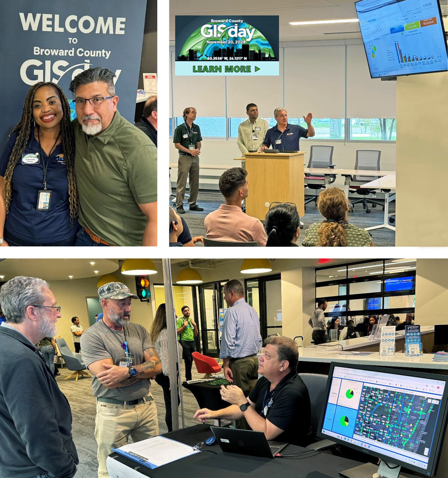
GIS Day featured many presentations, visitors, municipal collaborations, and special guest appearances.
Top left, clockwise to bottom: Broward County Chief Innovation Officer Leonard Vialpando and GIS
Program Manager Gabrielle Drice; Broward County Innovation Unit presentation; and a vendor mapping
demonstration with visitors. For more highlights and a recap of GIS Day, visit:
https://geohub-bcgis.opendata.arcgis.com/pages/gis-day
