
Resilient Environment Department: Drones, Imagery, and Visualization
Innovation is everywhere in Broward County – including “overhead!" A drone in the hands of a geoscientist is like a highly intelligent bird soaring the skies, collecting data, and understanding the world around us.
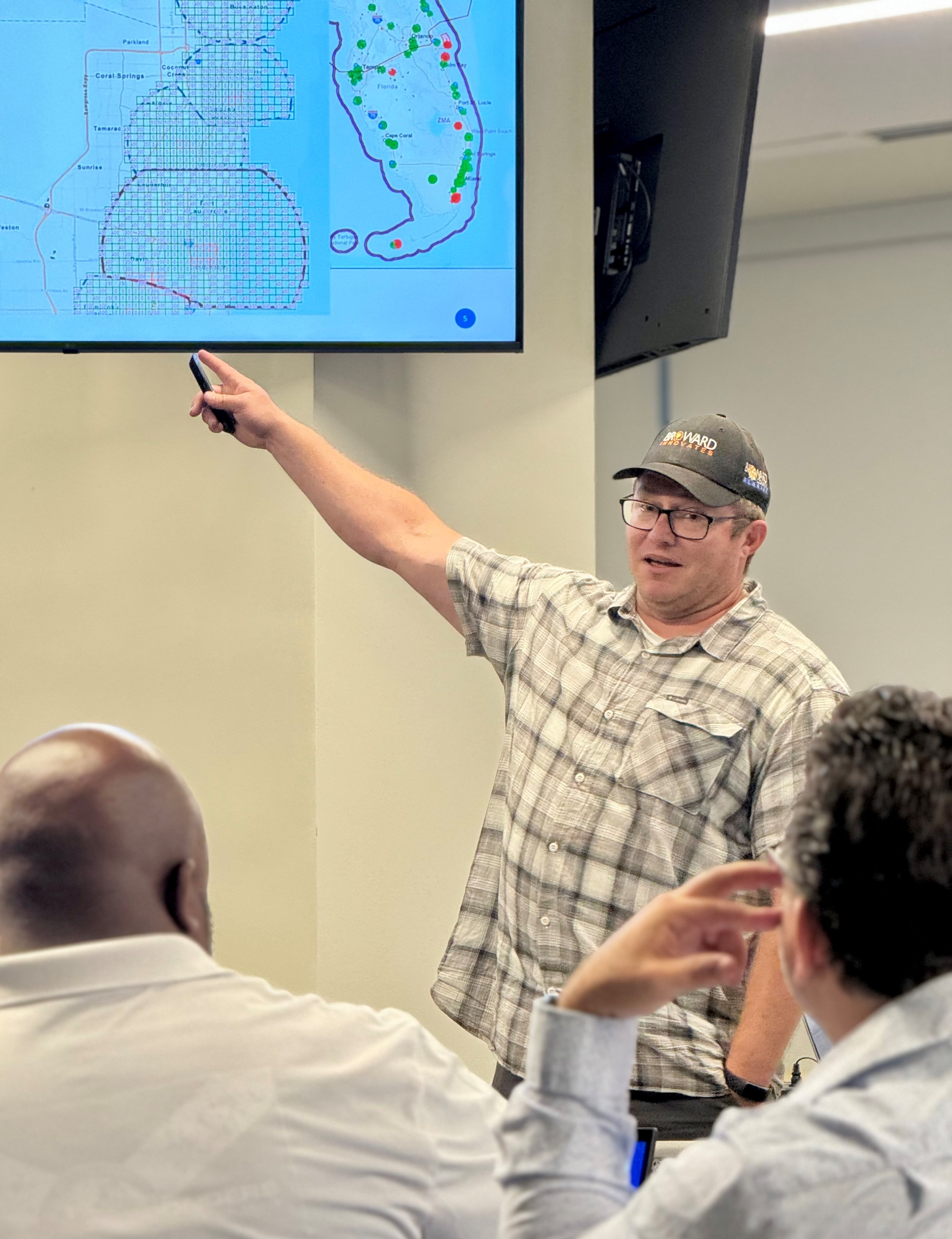
Recently, Broward County geoscientist and Assistant Chief Resilience Officer, Dr. Greg Mount, shared insights into how drones have been integrated into operations, leading to innovative approaches in emergency response, environmental monitoring, and public information sharing. Among other duties, Dr. Mount leads the drone program for the County's Resilient Environment Department.
Dr. Greg Mount holds drone workshops for County employees
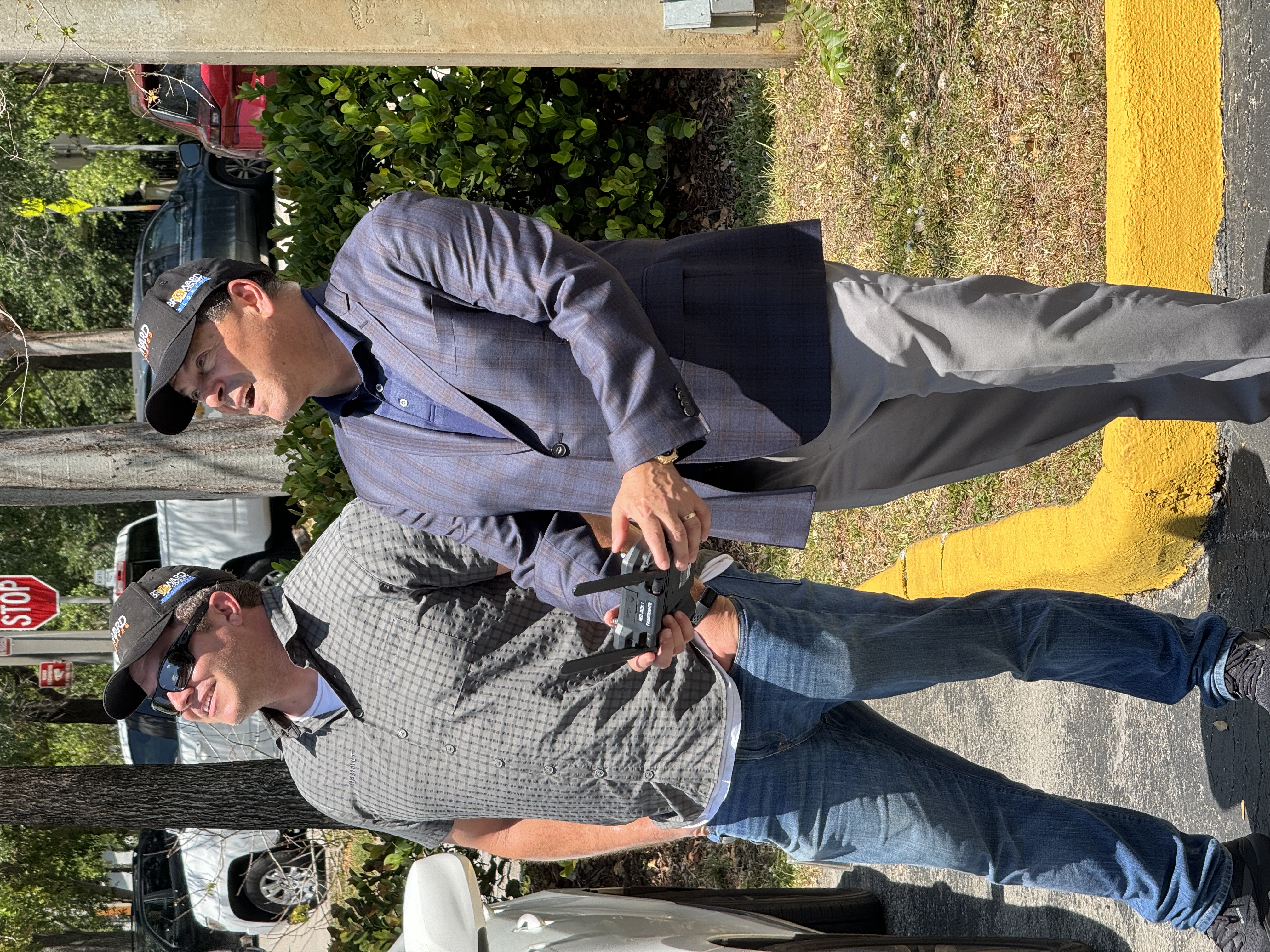
Broward County Commissioner Michael Udine flies a drone during Broward County Innovation Day
According to Dr. Mount, "The County has been doing drone work for at least eight years for flooding, social media, and public awareness. We are continuing to capture storm events and imagery to show situations as we encounter them in the field. The Resilience Unit has collected pre-storm imagery at the beach to look at changes due to tide and erosion. We used to do that from the ground, so this was a huge time savings.
We also partner with other agencies to help them address other challenges, such as high-resolution imagery for a construction project at Port Everglades, and collaboration with Public Works to create 3D models of parts of the County to plan for future projects. The drones add the ability for a reduced number of staff hours to accomplish more work, in a shorter time, at a cost savings to the County and our residents."
LiDAR Technology
Light Detection and Ranging (LiDAR) is a remote sensing method used to examine the surface of the Earth.
“A typical survey using LiDAR technology results in a relatively low resolution of 10 points per meter. When I fly a LiDAR-equipped drone, depending on my flight elevations, I get at least 300 points per meter, so I get really high-resolution ground detail. And my level of accuracy and precision is within a few millimeters. So, the type of data that I can collect, in a very short period of time and a very quick turnaround time for processing, is equal to months in time savings. Using traditional methods, it could have taken 3-6 months to collect and process the data. I can do the same using drone-mounted LiDAR in the same day."
“As another variation, I strapped that same LiDAR equipment to my backpack and rode my bicycle around my neighborhood and was able to do it in about seven minutes. That would take a surveying team of multiple people several days. I collected billions of points in less than seven minutes. I'm able to even map the leaves on the trees. An FPL crew of two to three people are collecting points manually; I collected billions of points in minutes."
“Once the data is collected, we upload the LiDAR into the “cloud," and we tell the software what we want it to look for.
When we are looking at where flooding occurs, we can see changes in the swales, or something that would influence the ponding of water or restrict water movement."
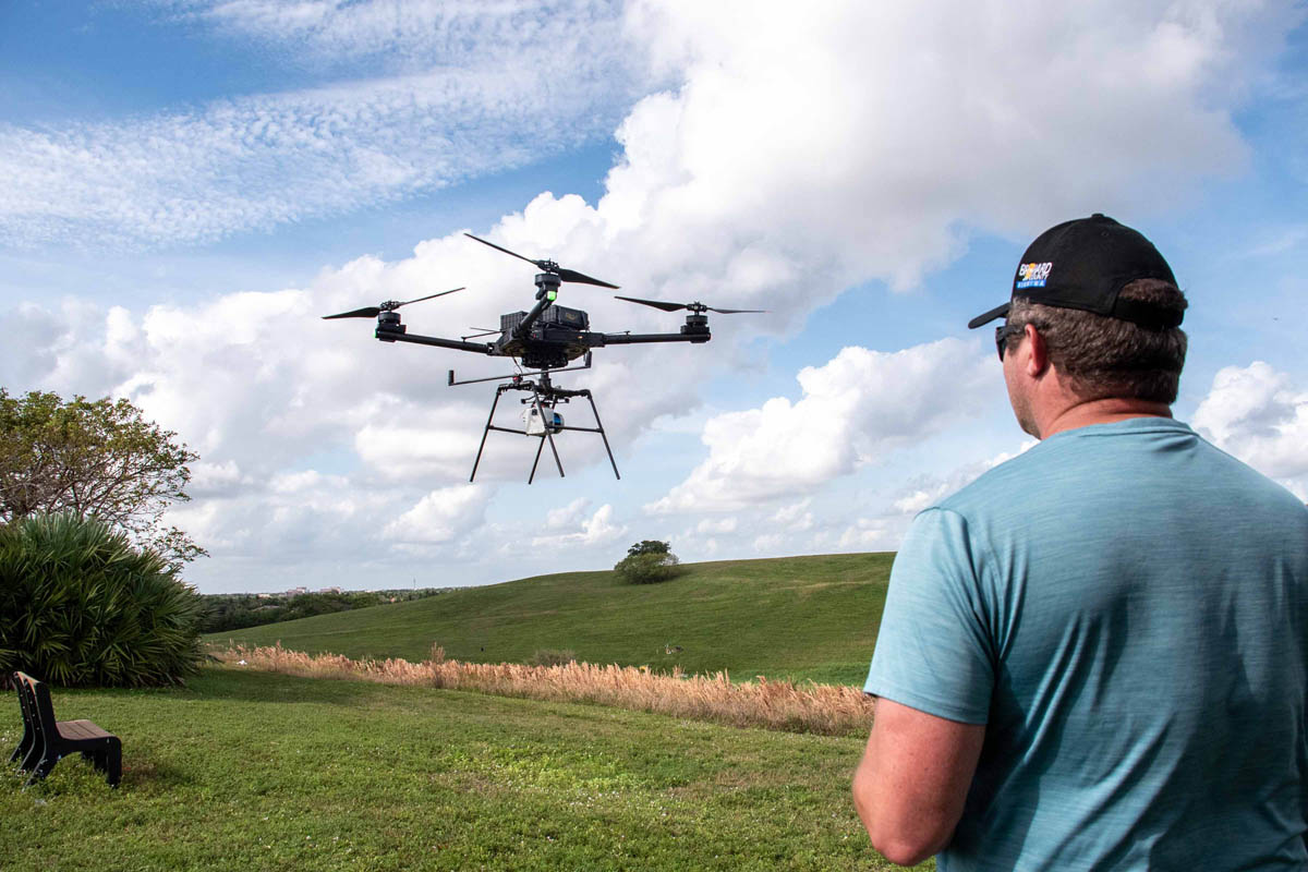 Dr. Greg Mount flies a drone in a local County Park
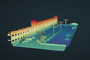 A 3D LiDAR photo collected from drone data
 Some innovative uses and benefits of Broward County's Drone Program
-
Cost-effective data collection: Using drones to collect data significantly reduces the costs of flight data collection which otherwise require expensive helicopter flights.
-
High-resolution 3D LiDAR mapping: A LiDAR-equipped drone can capture 3D models of the land and built environment to an accuracy of a few millimeters, providing precise and detailed topographical data.
-
Integration of Artificial Intelligence (AI) for infrastructure mapping: Employing AI to analyze LiDAR data and identify features like trees, power poles, and manholes automatically streamlines the process of infrastructure mapping, reducing human error, benefiting city planners, public works departments, and utility companies.
-
Portability and flexibility in data collection: Using portable LIDAR-equipped drones for on-the-go data collection has allowed for rapid and versatile data gathering in various conditions, supporting Broward County emergency responders, environmental researchers, and surveyors.
-
High-quality images and videos during storm events: Drones can be flown over flooded areas during storms, ensuring the accuracy of predictive models and helping to better understand flood patterns. This has improved public communication, understanding, and awareness of environmental and infrastructure conditions and is providing crucial information to local governments, and residents living in flood-prone areas.
In Conclusion
The integration of drone technology within Broward County's operations exemplifies how innovation can lead to significant improvements in efficiency and data accuracy. These advancements not only benefit government agencies and public services but also enhance the overall safety and quality of life for the community. By continuing to explore and adopt new technologies, organizations can stay ahead in addressing the ever-evolving challenges in disaster response and environmental management.
