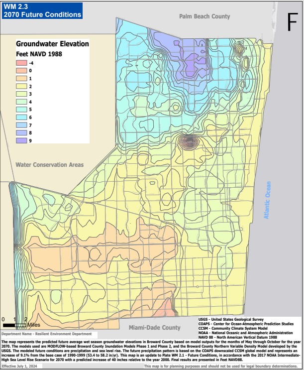
Future Conditions Groundwater Elevation
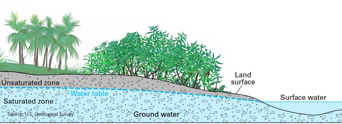
Ground water levels are expected to rise in the future due to the impacts of climate change
Broward County is taking a forward-looking approach to planning for future conditions predicted as a result of climate change, specifically the impacts of sea level rise with an emphasis on planning and design requirements for development, redevelopment, and investments in infrastructure. In 2017, the Broward County Board of County Commissioners established a Future Conditions Map Series, intended to evolve with the application of best available science to develop models and provide data to update design requirements for land use decisions, accounting for future flood and climate risk.
The first map in this series is the Future Conditions Groundwater Elevation Map, Plate WM 2.2 Future Conditions, which represents the expected future average wet season groundwater elevations for Broward County and is used when reviewing surface water management licenses.
For future conditions average wet season groundwater elevations:
Future Conditions Average Wet Season Groundwater Elevation Map