Future Conditions 100-Year Flood Elevation
|
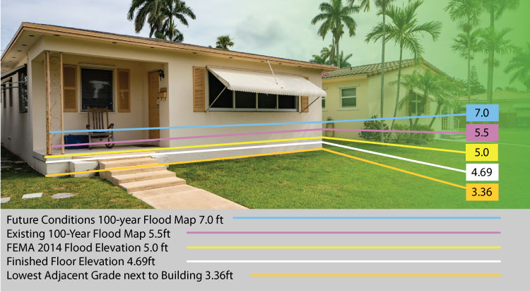
Flood levels are expected to increase in the future due to the impacts of climate change
Broward County is taking a forward-looking approach to planning for future conditions predicted as a result of climate change, specifically the impacts of sea level rise with an emphasis on planning and design requirements for development, redevelopment, and investments in infrastructure. In 2017, the Broward County Board of County Commissioners established a Future Conditions Map Series, intended to evolve with the application of best available science to develop models and provide data to update design requirements for land use decisions, accounting for future flood and climate risk. The first map in this series is
Future Conditions Groundwater Elevation Map.
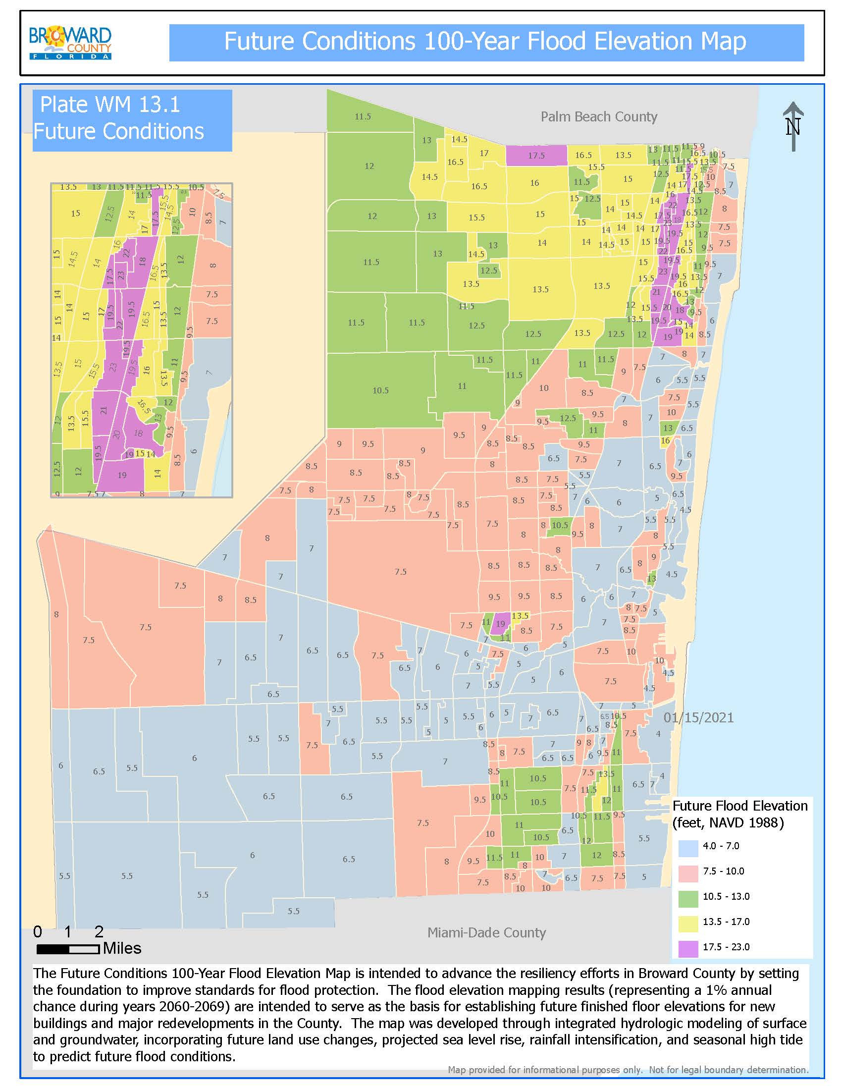
The second in this series, the Future Conditions 100-Year Flood Elevation Map, is intended to advance resiliency efforts to improve standards for flood protection. This modeling effort accounted for projected sea level rise, increased precipitation, saturated soil conditions, and land use changes to predict future flood conditions. The results of this project will serve as a regulatory basis for establishing future minimum habitable floor elevations for new buildings and major redevelopments in the County.
What is the Future Conditions 100-Year Flood Map?
Adopted by the Broward Board of County Commissioners on June 15, 2021, as part of the Code of Ordinances, the map (Plate WM 13.1 - Future Conditions), helps to ensure community resilience by ensuring that future flood elevations are incorporated in the planning and design requirements for lowest habitable finished floor elevations for residential and commercial structures - an action that will help protect against future flood risk and potential losses and preserve the affordability of flood insurance in Broward County.